

in the Volhynian part of Polisia, a raion center in Rivne oblast. The town has a food industry and a linen factory.
Maps, Weather, and Airports for Berezne, Ukraine
Rivne region
Rivne region is located on the Western-Eastern part of Ukraine. The territory of it is 20,1 th. sq. km. Its territory from the West to East is - 130 km, from the North to South is - 210 km, its borders of verge are Zhytomyr, Khmelnitski, Ternopil, Lviv, Volyn regions of Ukraine & Brest and Homel regions of Belorus...More

"The first mention refers to 1570. A historical name is Andriiw. Since XVI century it was given the City Right". [Dov Gutterman, 19 November 2001]
...The excellent nature landscapes are in the Berezne district, so called "Sokolyni gory ("Falcon mountains"), basalt columns of the Berestovets deposits in Kostopil district, amber deposits on the Northern districts of the region. There is very interesting to see the sights of the exotic kinds of trees dendro park of Berezne forest colleague..[http://www.obladmin.rv.ua/english/gen_uk.htm]
The Kostopol district - occupied the central-eastern section of the Wolhynia Voividship and shared borders to the west with the Luck district, to the north with the Sarny district, to the east bordered the Soviet Union and to the south the Rowne district. The surface area was 3,496 km2, population - 159,600 (according to the 1931 census) with the population density index of 46 persons per square kilometer.The district was primarily populated by ethnic Ukrainians, who amounted to 105,600 persons (66.1%). The second largest nationality were the Poles - 35,000. The remainder were Jews, Germans and other nationalities in small numbers.In the district territory existed 2 towns (Kostopol, Berezne), 6 village communes (gminy) and 233 individual village entities (communities - solectwa).Up to date, it could be established that on the territory of the Kostopol district genocide activities performed on the Polish population during the years 1939-1944 by the Ukrainian nationalists resulted in death of approximately 4.400 people. According to our estimates, this represents only approximately 60% of the total number of Poles murdered in the Kostopol district, which is estimated to be 7.000 persons.

Map of Poland 1921-1939 indicating the provinces (voivodships) and the village of Bystrzyce in Kostopol district, Wolyn voivodship.


The modern emblem The gonfalon
It was confirmed by village council at August, 7, 1998. A rectangular panel with a ratio of the sides 1:1. The yellow field is divided by azure Andrew's cross. In the top and bottom quarters are green birch leaflets, in right and left - a red entrance gate. The authors are A.Grechylo, Yu.Terlets'kyi.
עיירתי ברזנה מיין שטעטעלע בערעזנע
 | מפת מרכז העיר ברזנו כפי שצויירה מהזכרון במרץ 1954 ע"י דר' ביגיל מחבר הספר "עיירתי ברזנה" מיין שטעטעלע בערעזנע | |
 | A former synagogue in Berezno | |
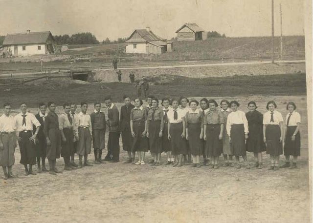
 | He-Halutz Aliya training group in Berezne; Volhynia | |
 | השומר הצעיר בברזנו לפני 39 | |
 | מדריך וחניכות בתנועת השומר הצעיר לפני 39 | |
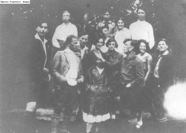 | חברי "השומר הצעיר" מקיבוץ ההכשרה "אף - על - פי". | |
 | Jewish survivors at the mass grave of Berezne Jews | |
 | ||
 | ||
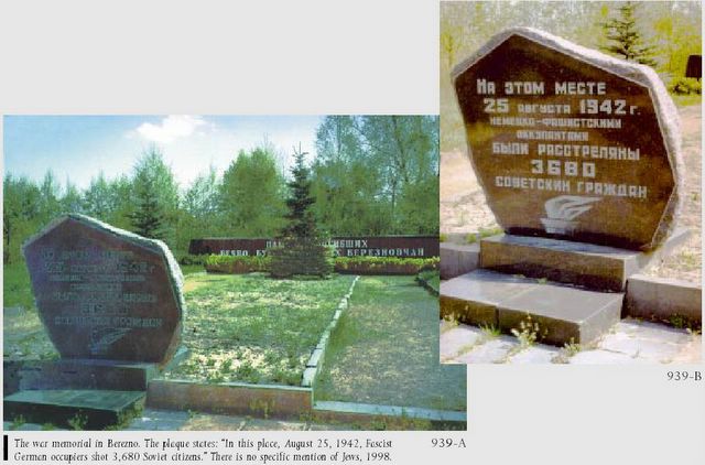 | berezno war memoorial | |
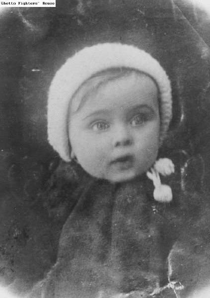 | הפעוטה ציפורה - פייגה קנוניץ, שנספתה |